Padre Canyon, Southern Utah
If you’re looking for a rewarding, challenging hike in Utah’s Red Rock Country without going too far, then Padre Canyon may have exactly what you’re looking for. Located on the south end of Snow Canyon State Park, the trailhead is just 20 minutes outside of St. George. In fact, the trail is in sight of nearby condos. The town of Ivins is visible for the first couple of miles until after you’ve crossed over the ridge into the back side of the canyon.
If you’re looking for an easier hike, check out Scout Cave, which is accessed from the same trailhead
You can do this trail as an out-and-back, climbing through the canyon to the top of the ridge, then returning back the way you came. And this is the shorter option, giving you about 6 miles. Or you can do it as a loop of just over 7 miles.
Trust me, do the loop because that’s where all the good stuff is.
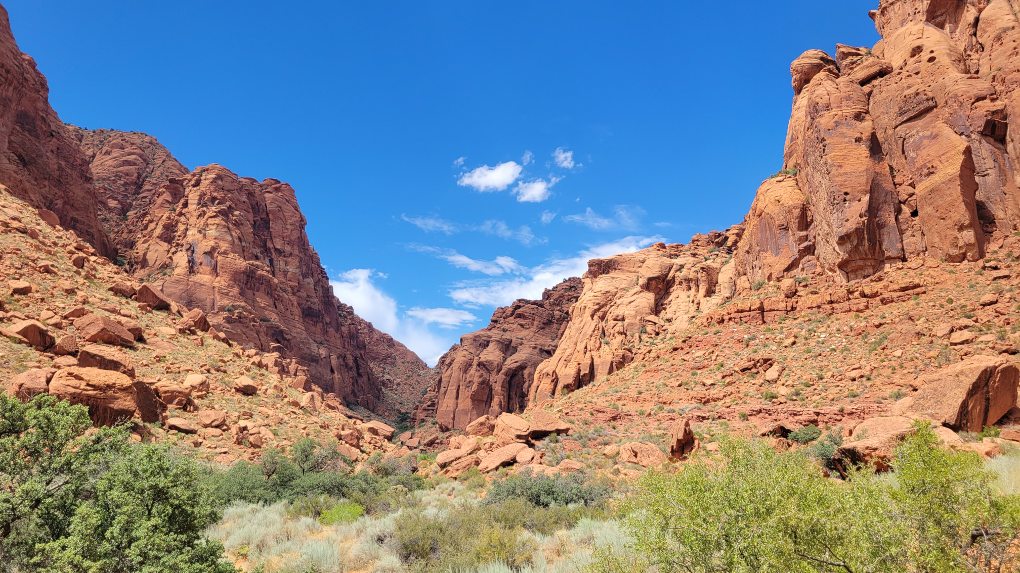
Any walk through Southern Utah’s Red Rocks is enjoyable, and every part of this trail offers spectacular sights. Red rock against deep blue sky with crisp white clouds offers iconic Utah views. Interesting formations in the sandstone are visible throughout. And the plant life is varied.
The first part of the trail from the trailhead is easy and relatively flat as you skirt the south edge of the ridge forming the canyon. As you turn north you stay on a log approach always in sight of civilization. It’s not until after you pass by and leave behind the iconic Tuacahn Amphitheater at about a mile and a half that you begin to feel like you’re in the wild.
This is also where the hike starts to get difficult as you begin the climb to the top of the canyon.


The Ascent
The ascent is challenging. It starts off slow, but near the top becomes fairly steep. Take your time, especially if you are hiking in the summer heat.
But the work is worth it, because when you reach the top you’re rewarded with amazing views in two directions. To the south you can look back at where you came from with Tuacahn at the mouth of the canyon. Ivins is in the middle ground. And the hills flanking Santa Clara and St. George beyond that. To the north you get your first views deeper into Snow Canyon and the Red Mountain Wilderness.
This is the point at which you can choose to turn around or drop down into the back side of the canyon. Continuing on is where you’ll be rewarded over and over again as you cross through several types of terrain on your way around the loop.
The Views From the Top


The climb down the other side crosses through classic slick rock washes with pools of water in the low spots. It passes below sheer cliffs and continual views to the contrasting white rocks to the north.
This is where you can begin to really feel alone for a while as you leave the nearby civilization behind and enjoy the wilderness.
Classic Southern Utah Beauty


After reaching the bottom of the canyon, you’ll turn to the east. Here you will join the Red Sand trail for a while. As the name suggests, you’ll spend some time walking through soft sand. So be prepared for some more difficult and slow going before you reach the east side of the mountain that you are circumventing.
Eventually you will arrive at the flat, gravel of West Canyon Road and turn south. By this point, the most difficult parts of the hike are behind you. All that remains is a long, gentle slope for about 1.5 miles back down to the trailhead. The road intersects the paved Whiptail Trail, where your walk out becomes even easier.

Hike Summary
Middle Aged Wife and I started this hike in the afternoon in mid August. So we made it more difficult that it would otherwise have been as we battled heat in the high 90s. We packed (and drank) plenty of water, though, and we took our time to avoid over-stressing ourselves. There is less than 1,000 feet of elevation gain, but it is all concentrated in a fairly short distance.
This hike is moderately difficult, but not out of reach for anyone who is reasonably healthy. I highly recommend this if you’re in the St. George area and looking for something more than an easy walk but still near by to town.
Stats
Total Distance: 7.1 Miles
Total Elevation Gain: 751 feet
Total Time: 4 Hours 50 Minutes
Check Out Some of Middle Aged Wanderer’s Favorite Hiking Gear.
NOTE: These are affiliate links and I earn a commission every time you purchase from one of them.
MSR MiniWorks Backcountry Water Filter
WACOOL 3L Hydration Bladder
Idaho Guide Books
The Hiker’s Guide Best Easy Hikes, Greater Boise by Scott Marchant
The Hiker’s Guide: Exploring Greater Boise by Scott Marchant
The Hiker’s Guide: McCall & Cascade by Scott Marchant
The Hiker’s Guide: Ketchum & Sun Valley by Scott Marchant


